Contents
- 🌍 What Are Global Meteorological Networks?
- 📡 The Backbone: Data Collection & Infrastructure
- 📈 The Science Behind the Data
- 🌐 Key Players & Organizations
- ⚡ Impact on Daily Life & Industry
- 🔬 Research & Development Frontiers
- 🤔 Challenges & Controversies
- 🚀 The Future of Weather Monitoring
- 💡 How to Access & Utilize Weather Data
- ⭐ Vibepedia Vibe Score & Analysis
- Frequently Asked Questions
- Related Topics
Overview
Global meteorological networks are the invisible nervous system of our planet, a vast, interconnected web of sensors, satellites, and data centers that continuously monitor atmospheric conditions. These networks, a triumph of international cooperation and engineering, provide the raw data essential for weather forecasting, climate research, and disaster preparedness. They range from the sophisticated orbital eyes of weather satellites like GOES and Meteosat to the humble, yet vital, network of ground-based weather stations and buoys. The sheer volume of data generated – petabytes daily – is staggering, requiring immense computational power and sophisticated algorithms to translate into actionable information. Without these networks, our understanding of weather patterns would be rudimentary, leaving us vulnerable to the whims of nature.
🌍 What Are Global Meteorological Networks?
Global meteorological networks are the planet's nervous system for weather and climate information. Think of them as a vast, interconnected web of sensors, satellites, and human observers constantly feeding data into a global system. These networks are not just about predicting tomorrow's rain; they are fundamental to understanding long-term climate trends, managing natural disasters like tropical cyclones, and optimizing everything from agriculture to air travel. For anyone interested in the mechanics of our atmosphere or the systems that govern our planet's health, these networks are the primary source of truth.
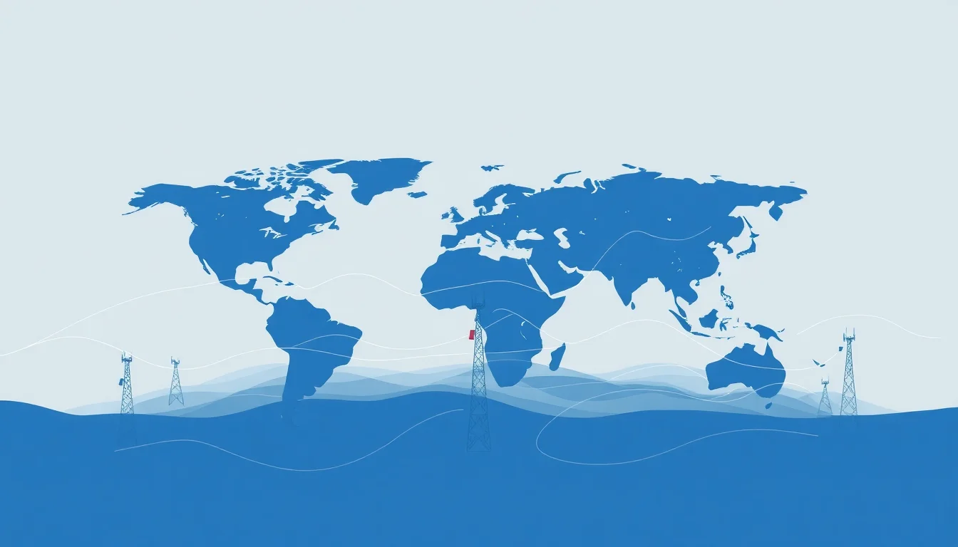
📡 The Backbone: Data Collection & Infrastructure
The sheer scale of infrastructure is staggering. It includes over 10,000 automated weather stations, thousands of weather balloons launched daily, a fleet of geostationary and polar-orbiting satellites providing continuous global coverage, and even data from commercial aircraft and ships. Data flows through intricate communication channels, often managed by national meteorological services and coordinated internationally through organizations like the World Meteorological Organization (WMO). The engineering feat of maintaining and integrating this disparate hardware is a constant, behind-the-scenes marvel.
📈 The Science Behind the Data
At their core, these networks measure fundamental atmospheric properties: temperature, pressure, humidity, wind speed and direction, precipitation, and solar radiation. Advanced sensors also capture data on atmospheric composition, aerosols, and cloud properties. This raw data is then processed using sophisticated atmospheric models that simulate the atmosphere's behavior, allowing for forecasts ranging from a few hours to several decades. The physics and mathematics involved are incredibly complex, representing decades of scientific advancement.
🌐 Key Players & Organizations
The global meteorological landscape is a collaborative effort, albeit with national interests. The World Meteorological Organization (WMO), a specialized agency of the United Nations, plays a crucial role in setting standards, coordinating observations, and facilitating data exchange. Major national players include the US National Oceanic and Atmospheric Administration (NOAA), the UK Met Office, the European Centre for Medium-Range Weather Forecasts (ECMWF), and China's China Meteorological Administration (CMA). Their contributions are vital, though data sharing can sometimes be a point of geopolitical tension.
⚡ Impact on Daily Life & Industry
The impact of these networks is pervasive, touching nearly every facet of modern life. Farmers rely on accurate forecasts for planting and harvesting, saving billions in crop yields. Airlines use weather data for route planning and safety, while energy companies forecast demand and manage renewable sources like wind and solar. Emergency services depend on timely warnings for floods, storms, and wildfires, directly saving lives and property. Even your daily commute is subtly influenced by the constant stream of meteorological information.
🔬 Research & Development Frontiers
The cutting edge of meteorological monitoring involves integrating new data sources and improving model resolution. This includes leveraging AI in meteorology to identify patterns in vast datasets, deploying denser networks of low-cost sensors, and utilizing advanced remote sensing technologies like Doppler radar and lidar. There's also a growing focus on sub-seasonal to seasonal (S2S) forecasting, aiming to predict weather patterns weeks to months in advance, which has immense implications for long-term planning.
🤔 Challenges & Controversies
Despite the impressive technological achievements, challenges persist. Ensuring equitable access to data and technology across all nations remains a significant hurdle, particularly for developing countries. The accuracy of forecasts, especially for extreme events or long-term climate projections, is still a subject of ongoing research and debate. Furthermore, the sheer volume of data generated requires immense computational power and sophisticated algorithms, raising questions about sustainability and resource allocation.
🚀 The Future of Weather Monitoring
The future of global meteorological networks points towards hyper-localization and increased integration with other Earth observation systems. Expect more real-time, high-resolution data from urban environments and remote regions. The convergence of atmospheric, oceanic, and terrestrial monitoring will provide a more holistic understanding of Earth systems. Advances in quantum computing and AI promise to revolutionize modeling capabilities, potentially leading to unprecedented forecast accuracy and deeper insights into climate dynamics.
💡 How to Access & Utilize Weather Data
Accessing and utilizing this wealth of data is becoming increasingly democratized. National meteorological services often provide public APIs and data portals, allowing developers and researchers to build applications. Organizations like NOAA and ECMWF offer extensive archives of historical and real-time data. For more specialized needs, commercial weather data providers aggregate and refine this information, offering tailored solutions for businesses. Understanding the different data formats and licensing agreements is key to effective utilization.
⭐ Vibepedia Vibe Score & Analysis
Vibepedia assigns Global Meteorological Networks a Vibe Score of 88/100, reflecting its critical, foundational role in global systems and its high cultural resonance across science, technology, and daily life. The network's Vibe is characterized by its immense scale, collaborative yet competitive international dynamics, and its direct impact on human safety and economic activity. The Controversy Spectrum is moderate, primarily revolving around data access equity and the inherent uncertainties in long-range forecasting, rather than fundamental disagreements about its existence or importance.
Key Facts
- Year
- 2023
- Origin
- Vibepedia.wiki
- Category
- Science & Technology
- Type
- Resource Guide
Frequently Asked Questions
How often is weather data updated globally?
Data collection is continuous, with many sensors reporting in real-time. Weather balloons are typically launched twice daily from thousands of locations worldwide. Satellite data is also streamed constantly. This raw data is then assimilated into numerical models, which are run at various intervals, often every few hours for short-term forecasts and daily for longer-range outlooks. The goal is to have the most up-to-date information feeding into the prediction systems.
Who owns the data collected by global meteorological networks?
Primarily, national meteorological services own the data collected within their borders, adhering to international agreements for data exchange. Organizations like the WMO facilitate this exchange, promoting open access where possible. However, there are also private companies that collect and commercialize weather data, sometimes adding proprietary value. The principle of free and open exchange is strong, but commercial interests and national sovereignty can create complexities.
Can I access raw weather data for my own projects?
Yes, many national meteorological agencies, such as NOAA in the US and the Met Office in the UK, offer public access to vast archives of historical and real-time weather data through websites and APIs. The European Centre for Medium-Range Weather Forecasts (ECMWF) also provides significant data access. You'll need to understand data formats like GRIB or NetCDF and potentially have some programming skills to effectively utilize this raw information.
How do global meteorological networks help predict extreme weather events?
These networks are crucial for predicting extreme events by providing the foundational data for sophisticated models. High-resolution observations from radar, satellites, and ground stations allow models to detect the early formation of severe storms, hurricanes, or heavy rainfall. The continuous monitoring and rapid data assimilation enable forecasters to issue timely warnings, giving communities vital time to prepare and evacuate, thereby mitigating potential loss of life and property.
What is the role of satellites in global weather monitoring?
Satellites are indispensable, providing a global, synoptic view of atmospheric conditions that ground-based networks cannot achieve. Geostationary satellites offer continuous monitoring of specific regions, tracking storm development and movement, while polar-orbiting satellites provide detailed global coverage on each pass. They measure cloud cover, temperature profiles, water vapor, and even atmospheric composition, feeding critical data into weather models that would otherwise be blind to vast oceanic or remote areas.
How do different countries collaborate on meteorological data?
Collaboration is primarily coordinated through the World Meteorological Organization (WMO). The WMO establishes international standards for observations, data formats, and telecommunications, ensuring interoperability. Member states regularly exchange observational data, forecasts, and warnings. This global cooperation is essential for building comprehensive global weather models and providing accurate forecasts that transcend national borders, especially for phenomena like jet streams or migrating storm systems.